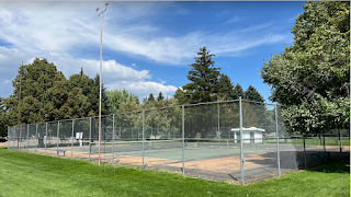
School District & City Tennis Courts Agreement

The first part of the city council meeting last night was great. After a few intense months of planning and negotiating, the city council approved an agreement with the school district to help fund six new tennis courts for use by the district and the city residents. Members of the school board and the district superintendent spoke during public comment to encourage the council to take this step with them.
It's a good deal for the city, and if we hadn’t approved it, I’m confident that in the future, we would have been kicking ourselves for not doing it. The courts will be enjoyed by everyone for decades to come. I appreciate Jason Flaig and the other members of his “tennis court” committee, who served as the chief researchers, planners, and negotiators for this project. They provided the energy needed to finally get this worthwhile project moving. Well done!
Roads on Jr. High Property
The second part of the city council meeting last night was not as successful. The issue of where to put the north-south road(s) across the jr. high property was discussed. I’ve mentioned this issue previously on this blog. Last night was the first time I personally have heard the school district officials address the issue directly. I appreciated hearing from them. It was probably a meeting that should have happened a couple of years ago.
It’s a complex challenge and both the school district officials and the city administrators have compelling arguments for their current positions. Let me try to explain the problem concisely if I can. Below, I have included a map of the area being discussed.
The school district, like all other land developers, has to allow for transportation routes through their property as it gets developed. There are numerous reasons for this: emergency services and disaster evacuation routes, commercial and residential traffic access and flow, drivable and walkable routes connecting neighborhoods or areas of the city to all other areas, allowing access to other property owned by others who may wish to develop, etc.
With the jr high property, the previous landowner (the Dalling family), when they very generously donated the property to the school district, wisely reserved two 60-ft easements on the east and west edges of the property. These right-of-ways would allow for their property to the east and north of the jr. high property to be connected to the rest of the city when those properties are developed in the future. The roads are required to be developed as the property is developed. The easements can be adjusted according to the city’s assessment to be in line with the transportation plan (basically, the grid system, in our case) and as the city projects out the anticipated growth in the city over the next 5, 10, 30 years and as the city accounts for all of the factors mentioned above.
A worse-case scenario is that a city doesn’t adequately plan for growth or plan for and protect an adequate transportation layout far enough in advance or well enough and it ends up with “dead-end” sections of the city that aren’t effectively connected to the rest of the city and only have one basic route for egress, or the city ends up with limited options for traffic flow as the city grows. Examples of both issues can be found in Rexburg. For example, anyone driving in Rexburg, knows it is in desperate need of more north-south oriented roads to relieve the pressure on 2nd east. But the city has very few options at this point.
Another worse-case scenario is that the city gets accused of or sued for an illegal “taking” by not having proper access to a landowner’s property within the city, thus limiting the use and development options for the property owner and severely reducing the value of the property.
The current situation here in Sugar is that the city needs to determine the routes through the jr high property. The city assessment has determined that the best route is Park Avenue. The school district doesn’t agree.
I’ll see if I can outline the issues and arguments clearly and explain my thinking. I’m not confident I can completely explain the school district’s position on every issue here, but I will state it as I understand it. I’m also speaking for myself as one member of the city council.
Roads through the jr high property would cause safety concerns for students now and in the future as the land continues to be developed.
· This is a concern. A straight north extension of Park Avenue would run very close to the backside (the east side) of the jr high building, closer than any of the other roads that run by the district’s schools, except the Valley View Alternative High School building on Center and Cutler.
· In addition to desiring safe roads for everyone, one of the city’s main concerns with safety is its obligation to require connectivity through the city. This is vitally important for emergency situations and emergency services. Heaven forbid, but if there is ever a need to evacuate the city or even just the school, without an adequate road network, people’s lives could be put at risk. Or if emergency services are coming in as residents are evacuating, all on the same limited roads, it would not be good. There are safety precautions that could be taken on roads that go through the jr high property, including a straight north extension of Park Ave. As the city has done with other projects designed to keep students and other residents safe, I’m confident the city and the district can make sure the students remain safe if that is the way this ends up going.
We don’t want semi-trucks lumbering up and down Park Avenue, trying to get to a fabrication plant or other type of facility to the north of the jr high.
· There are options for limiting certain roads to certain types of traffic. Also, I can’t imagine a truck driver exiting the hwy and trying to pass through the city to use Park Avenue to get to the property to the north of the jr high, when the driver could take other, more direct routes coming into the property from the north or east instead. There is a planned 6th North street that would run east to west coming in off of 7th East (Digger Drive). This road is the one that Park Avenue would connect to in the north.
3rd North is already very congested because of the three schools all in that area: the Jr. High, Kershaw, and Central, and more roads in this area will make things worse.
· Anyone who has driven in that area when school is starting or getting out can agree that it’s crowded. I might suggest that road congestion is the exact reason we need these additional routes through the jr. high property. Imagine the land to the north and the east of the jr.high (and farther out) being developed with both commercial and residential units, and those families driving their kids around to Kershaw or Central or the Jr. High. If there are no additional roads through the district’s property, the congestion on 3rd North will grow worse. It won’t get better by having fewer options for parents to take.
The high school soccer field would have to be moved if Park Avenue is extended.
· I’m a soccer guy. I love the soccer field facility. I love going to the matches there, especially at night—very cool! It’s a high- quality facility. The field was built over the 60-ft easement on the east edge of the property and even if that easement were to be vacated and the right of way moved to the Park Avenue extension, the soccer field would still be affected.
If there must be a road or roads through the jr high property, why can’t we extend Fremont Avenue instead?
· Other possible grid routes were considered. For me, there were problems with Fremont. It doesn’t provide central access to the property to the north of the jr high property. If Fremont is extended north, it connects to the far southwest tip of the property, as opposed to Park Avenue, which connects centrally. In fact, Fremont only provides the same level of access to the north property as the easement that is already located on the west edge of the property. Also, using Fremont would open up another residential street in the city to increased traffic. Park Avenue already has regular traffic on it, as it is used for access to Heritage and Veteran’s Parks, the grey church building, and Central Elementary. It is also used for those going to Kershaw or the Jr high, for example, after dropping off kids at Central or vice-versa. It seems a good idea to try to avoid increasing traffic in other neighborhood streets.
Does this have to be decided now?
· For all parties involved—the property owners, the school district, and the city—it needs to be decided as soon as possible. Each of these parties is making plans that require this issue settled.
So is this a done deal?
· It’s not a “done deal” yet. The city is the
final decision-maker in this situation; however, I would prefer to figure out a
way to reduce the impact on the school district’s current and future facilities
and plans by coming up with a decision that both the city and the district can
live with while still meeting their institutional and legal obligations and protecting
the rights of the property owners involved. I’m making no predictions or promises
about how that might be accomplished, but it’s being worked on, and I like to be optimistic.
